For schools and municipalities
From the survey to the school route plan: the process with Zebrio
With Zebrio a school gets from the parents' survey to a printed school route plan, without paper forms and without counting by hand. This page shows who does what and when, and what comes out of it.
The process at a glance
Set up: with a link from the operator, the school sets up the survey in about 10 minutes and prints its key sheet.
Ask: parents get a letter with a QR code, draw their child's route to school and mark dangerous and good spots.
Analyse: with the key sheet the school opens the analysis and sees routes, dangerous spots and means of transport on a map.
Plan: from the results the school draws the school route plan in the planning tool, prints it and passes it on.
Survey, analysis and planning
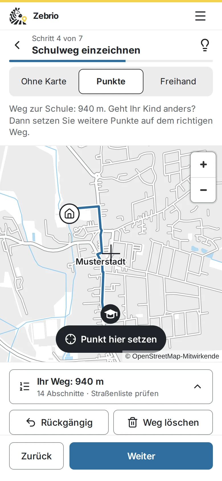
The surveyParents draw the route to school on a phone or a computer. 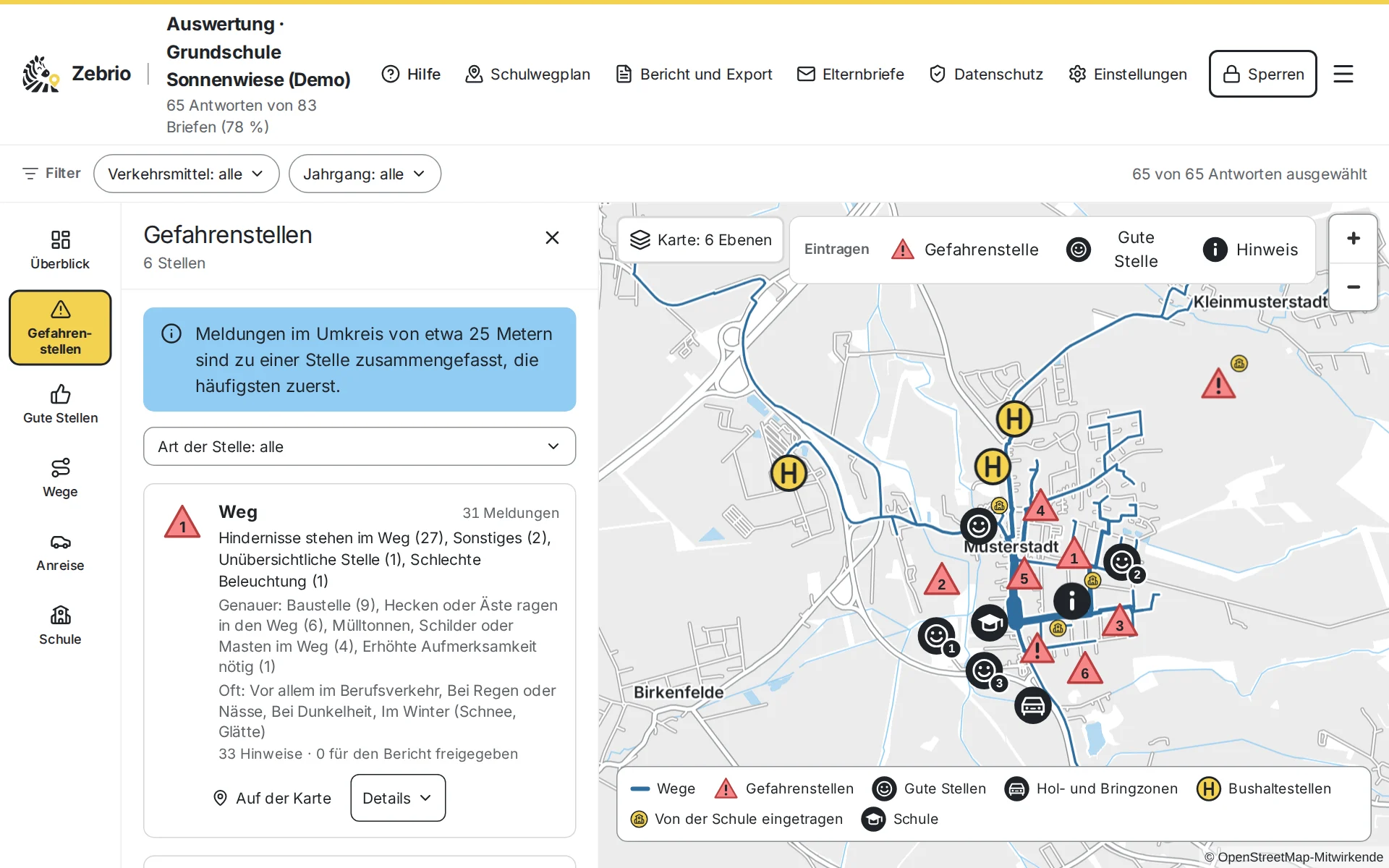
The analysisThe school sees the children's routes and the dangerous spots, grouped by place, on a map. 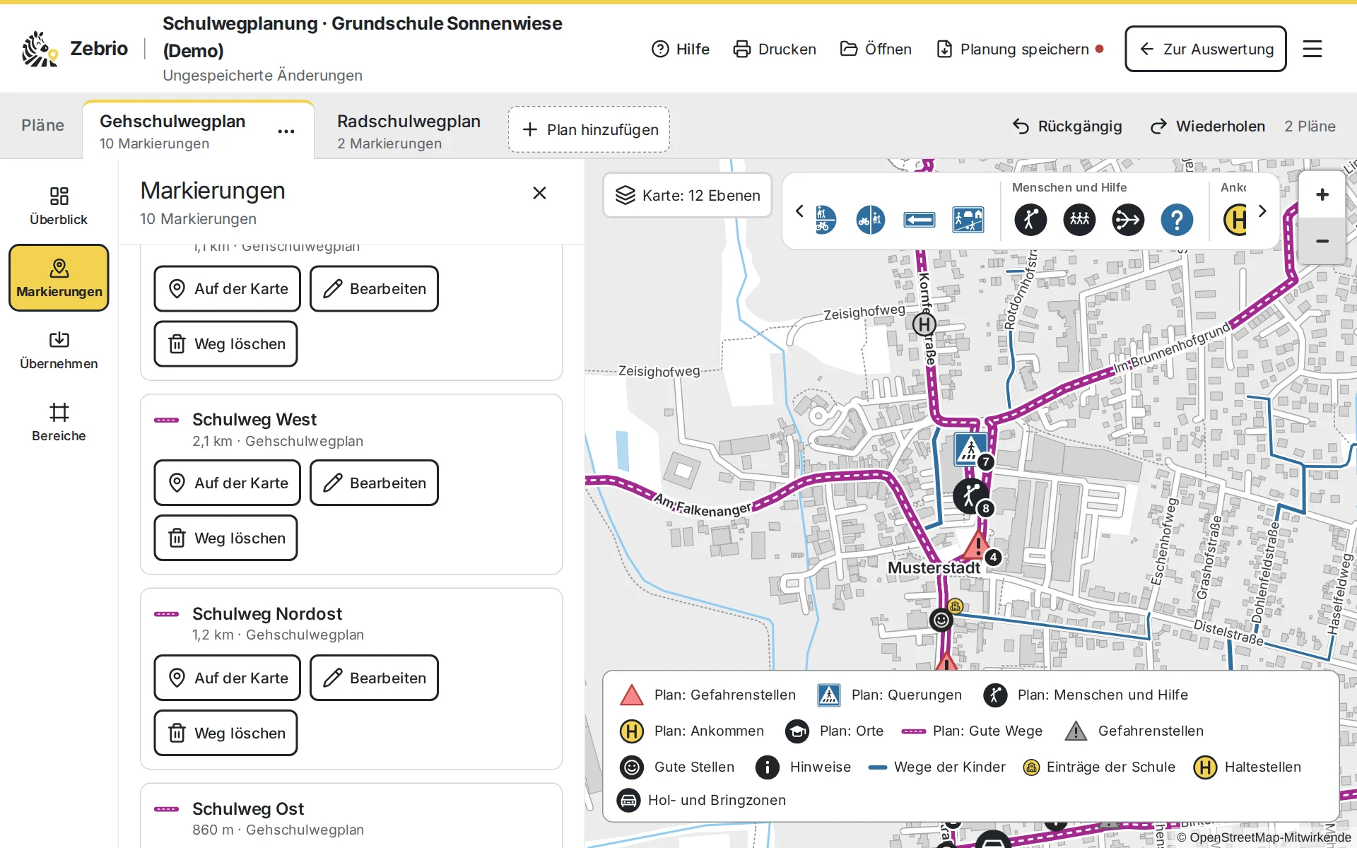
The planningThe results become the school route plan, with recommended routes and symbols.
The pictures come from the demo: Grundschule Sonnenwiese in the invented town of Musterstadt, with sample answers. The screens are in German.
Step by step
Ask for a setup link
The school sends the operator its name and gets a personal link for the setup.
Set up the survey
The school's key is created in the browser. The school prints the key sheet twice and keeps it safe: only with it can the answers be read.
Hand out the letters
Zebrio makes a letter for every child with its own code and QR code. The classes hand them out.
Parents answer
On a phone or a computer, in about 10 minutes, in German or English. The answers are encrypted on the device before they are sent.
Analyse
The school scans its key sheet and the answers are decrypted in its browser: the most used routes, dangerous spots grouped by place, means of transport and the reasons for driving children.
Approve notes and report
The school reads the parents' notes and approves what goes into the report. The report and the GIS data go to the municipality and the traffic authority.
Draw the school route plan
From the analysis the school opens the planning tool, takes over results, draws the recommended routes and places the symbols of the school route plan.
Print and pass on
The plan is printed as a PDF, saved as an image for the newsletter and notice board, or passed on to the municipality as data.
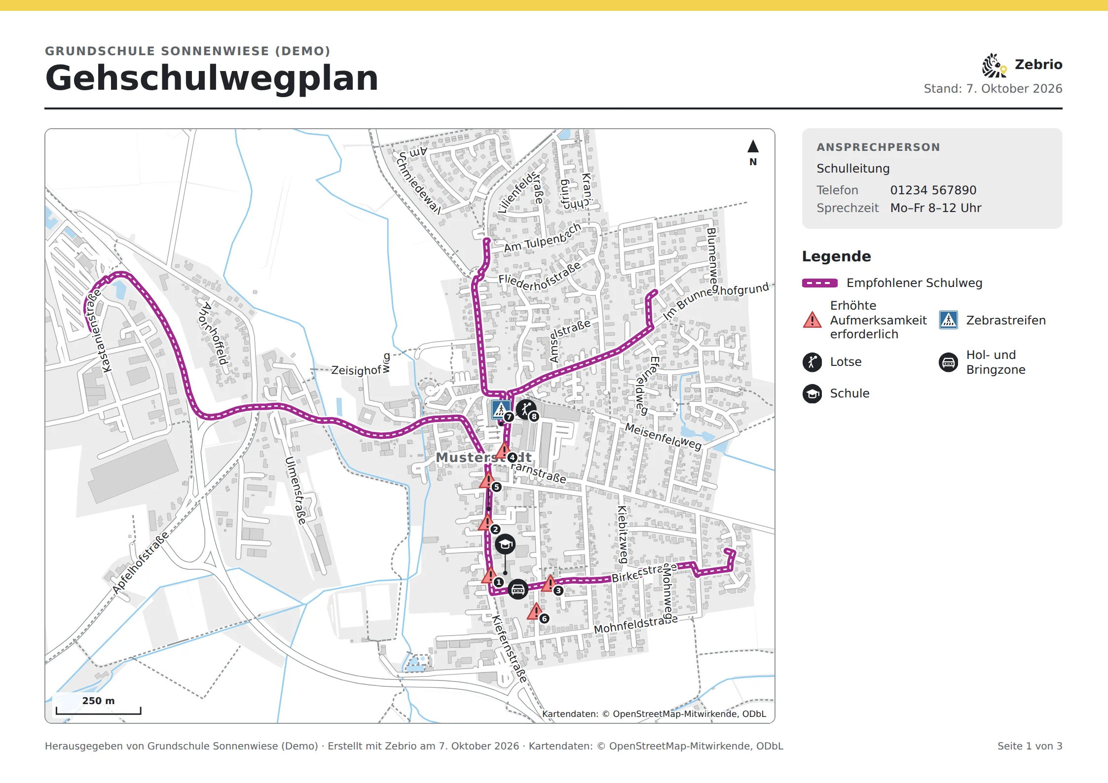
What your school route plan could look like
Who does what?
The school runs the survey and is responsible for the data. Parents share what they know about the way to school. The municipality and the traffic authority get summarised results and the plan and look into measures. The parents' council can get the survey started and help hand out the letters.
Schoolsets up, hands out the letters, analyses and draws the plan
Parentsdraw the route to school and report dangerous and good spots
Municipality and traffic authorityget the report, GIS data and the plan and look into measures
Children and familiesget the finished school route plan and practise the way
Time needed
Most of the time the survey runs by itself. For the school there are only a few fixed dates: set up, hand out the letters, remind and analyse. The school works on the plan as long as it likes; drafts stay in the browser and can be saved as a file.
About 10 minutes to set up
About four weeks, with one reminder
Every answer is in the analysis at once
Data protection
The server holds the answers only encrypted; only the school can read them, with its key sheet. The analysis and the planning run in the school's browser. The plan contains only summarised results, never a single child's route, so it can be passed on like a report.
What everyone can rely on
- No names and no addresses
- Decrypted only in the school's browser
- The plan stays in the browser or in your file
- Old entries are deleted automatically
Try it first
In the demo you play through a school route survey at the invented Sonnenwiese primary school in Musterstadt, from both sides. As a parent you draw a route to school and mark dangerous and good spots. As the school you open the analysis with the key sheet and see the answers of 60 sample families on the map, up to the finished report. So you know beforehand exactly what it means for the school and the parents. You get a personal access for 14 days on request by email. The demo is in German.
As a parent
Draw the route to school, mark dangerous and good spots, send it encrypted.
As the school
The analysis with the map, problem spots, means of transport and the reasons for driving children.
The report
Ready for the municipality and the traffic authority, as a web page, PDF and GIS data.
- The planning toolDraw a school route plan from the results, print it and pass it on.
- Survey guideA timetable and texts to copy for the newsletter, parents' evening and reminder.
- Creating a school route planHow a parents' survey provides the basis for the walking and cycling route plan.
- Data protection in the surveyEncrypted, without names and without tracking.
Zebrio at your school too?
Schools, parents' councils and municipalities that would like to run a school route survey can simply send us an email. We answer your questions and set up the survey for the school.